Petersfield to Rowlands Castle (20 miles linear) W2PS7
10 people attending
1 place left
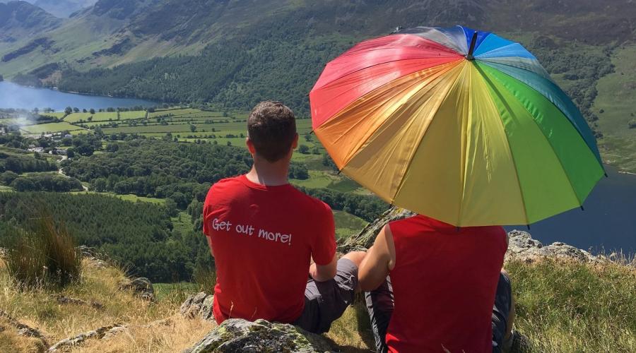
Join me for a linear hike from Petersfield to Rowlands Castle - a long day with rewarding views of picturesque Hampshire villages, a curiously remote church and the mighty South Downs.
From Petersfield we head out west, sneaking up on East Meon from above. We descend into the pretty village and then make our way back south east through rolling farmland before climbing up onto Butser Hill, the highest point on the chalk ridge of the South Downs. At 270m we'll get great views back over this morning's trails.
We descend Butser Hill through the Queen Elizabeth Country Park to pass under the A3, before picking up the Staunton Way heading south. We soon stroll into Chalton where, time permitting, we might inspect the inside of the Red Lion Pub.
We continue following the Staunton Way south, along a broad ridge before dropping down and crossing the railway line to visit the remote St Hubert's Church in Idsworth (http://bitaboutbritain.com/st-huberts-idsworth/) .
From here we're on the final stretch, continuing south to Rowland's Castle, skirting Stanstead Forest.
Note that it's likely to be a late finish of 6:30pm / 7pm due to the long distance covered.
---
Note that we will need to set a good pace (2.5 miles / hr) over a long day to finish at a decent time, so keep that in mind when signing up.
---
What's the W2P S7 mean in the title? It stands for Waterloo to Portsmouth Stage 7 - This year I decided to lead a series of 8 linear walks which will take us all the way from London Waterloo to Portsmouth (W2P). This is the 7th walk of the series. If you haven't done any of the previous stages - or can't do any future ones (i.e. the last one!) - please still free to join. Each walk on its own should still be a great day out.
Proposed remaining legs / dates (not set in stone yet but likely dates at this stage.)
- Stage 8 : Rowlands Castle -> Portsmouth Harbour - 17th August (not yet posted)
--- media rights ---
Photo attributions in order of appearance
- Heading Down Butser Hill. © David Zerk
- Downland above Coombe, East Meon
cc-by-sa/2.0 - © Andrew Smith - geograph.org.uk/p/1593165 - River Meon beside the High Street, East Meon
cc-by-sa/2.0 - © Peter Facey - geograph.org.uk/p/2509908 - All Saints' Church, East Meon
cc-by-sa/2.0 - © David Martin - geograph.org.uk/p/5805270 - South Downs Way going up Butser Hill
cc-by-sa/2.0 - © Trevor Harris - geograph.org.uk/p/3643122 - Red Lion
cc-by-sa/2.0 - © N Chadwick - geograph.org.uk/p/2686107 - The Staunton Way on Chalton Down
cc-by-sa/2.0 - © Shazz - geograph.org.uk/p/1923513 - St Hubert's Chapel, Idsworth (2)
cc-by-sa/2.0 - © Barry Shimmon - geograph.org.uk/p/4056240 - The Castle Inn. Rowlands Castle © David Zerk

What to bring
Water: bring at least two litres of water - it's a long day out and might be warm this time of year.
Medicines: if you have hay fever, diabetes, minor ailments etc.
Rucksack: or any other bag
Footwear: hiking boots.
Layered clothing: lets you quickly adapt to changes in the weather and body temperature. Go for a base layer (vest or t-shirt) and a mid layer (a micro fleece or shirt) and in cooler weather add an outer layer (a windproof jacket or thick fleece)
Trousers: ideally not jeans which become heavy and cold in the rain, breathable fabrics are more comfortable and dry.
Waterproof jacket: breathable fabrics are more comfortable and dry
Hat or cap: stay warm in winter and shaded in summer
Sunglasses: you never know ....
Sun cream: can be useful even on cloudy and winter days
Snacks: bring biscuits, energy bars, nuts, bananas, chocolate or dried fruit for example and put them somewhere easy to get hold of
Food & drink
Bring a packed lunch and plenty of water / snacks. We need to make a prompt start in Petersfield so come prepared.
Time permitting we may stop for a beverage at a pub, so bring your wallet :)