Cranborne Chase and a Sixpenny
20 people attending
0 places left
1 person waitlisted
Whether on the neolithic Dorset Cursus, the Roman Ackling Dyke or the modern A354, people have crossed this comely corner of Dorset for centuries. But they have also known the value of lingering in this lovely locale, whether for a lifetime in the timber-framed cottages and stone-built mansions that outnumber the modern houses, or for eternity in the burial mounds that are as thick as the winter wheat. Our crossing and lingering will last just six hours as we complete this enjoyable jaunt, planned at the sweet spot where a fertile vale of sandy clay meets an expansive plateau of chalk.
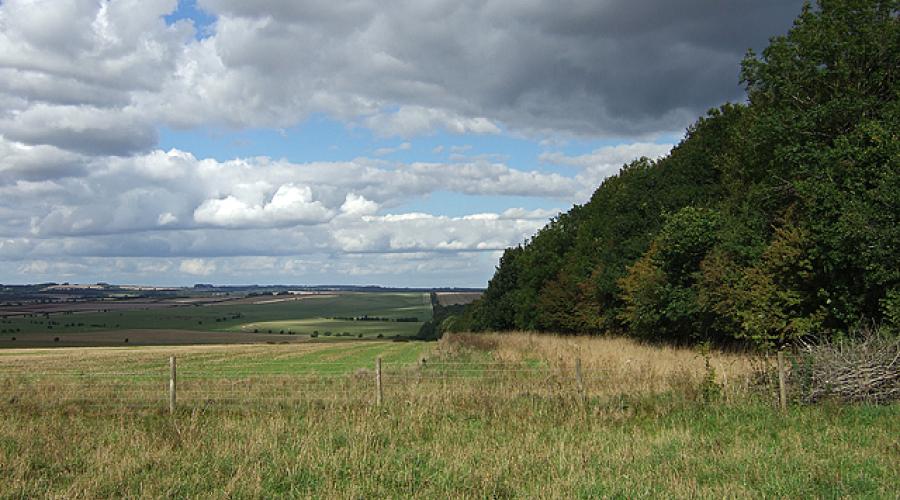
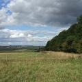
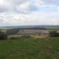
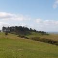
The plateau is Cranborne Chase, which the route will touch on. The sixth largest Area of Outstanding Natural Beauty in the country, and at the meeting point of Salisbury Plain, the West Wiltshire Downs and the Dorset Downs. Chalk is the predominant geology and chalk downland the predominant ecology, but the Chase has much variety.
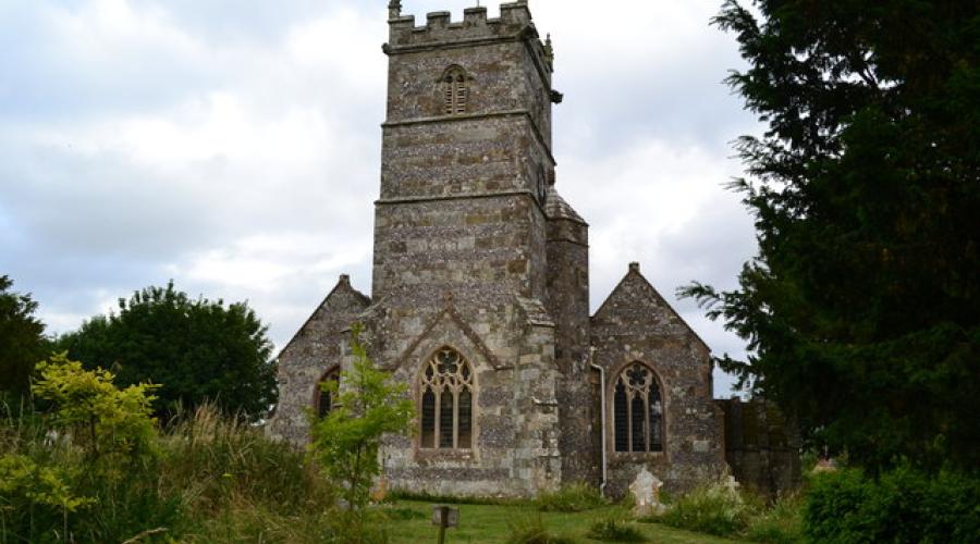
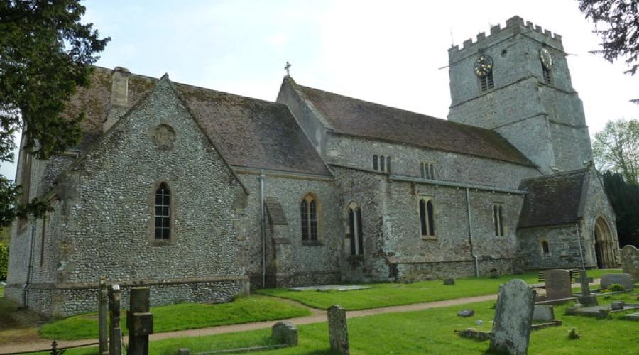
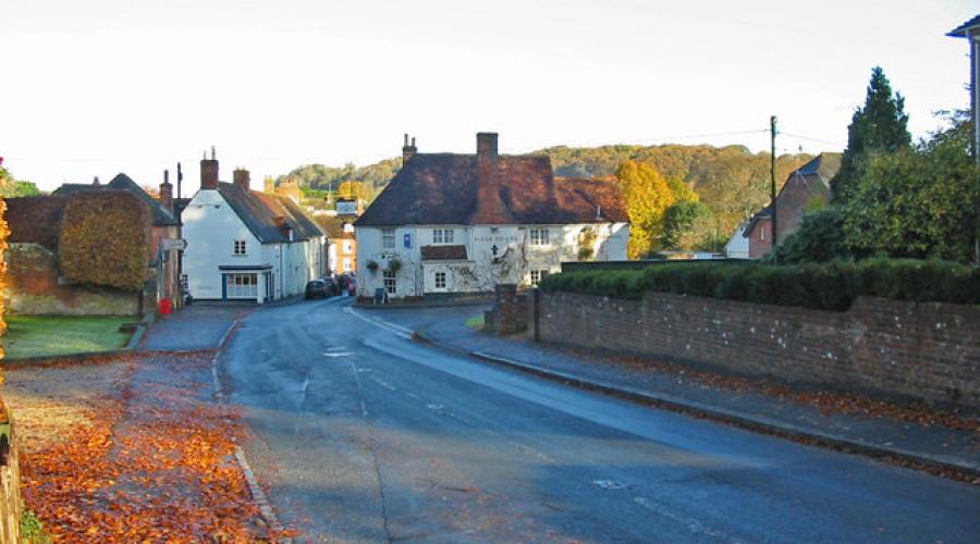
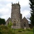
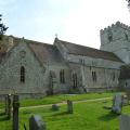
The downs are named after the village of Cranborne, founded by the Saxons, which had a manor house and a small monastery. The word 'chase' comes from the hunts, undertaken by royalty (including Kings John, Henry VIII and James I), which took place on the downs. The Manor House is mostly Jacobean, rebuilt by Robert Cecil, Earl of Salisbury, minister under James I, as a hunting lodge. A later inhabitant was Viscount Cranborne, former Conservative leader of the House of Lords. The church of St Mary and St Bartholomew is large, 12th century originally, now mostly 13th to 15th centuries with a massive 15th century tower and 14th century wall-paintings.
The archaeology in this area is prodigious. Wor Barrow is a large neolithic (3500-2500 BCE) long barrow, excavated by the pioneer of scientific British field archaeology, Sir Augustus Pitt-Rivers in 1893-4. Ackling Dyke is the Roman Road from Dorchester to Old Sarum and the most impressive and best-preserved stretch of Roman road in Southern Britain. The agger (embankment) is over 2 metres high in places and the width is over 15 metres. It crosses the Dorset Cursus (a neolithic processional path associated with ancestor-worship) near the route of the walk. There are almost a hundred barrows (bowl, bell and disc) dotted all around, dating from the neolithic to the bronze age (1500-800BCE).
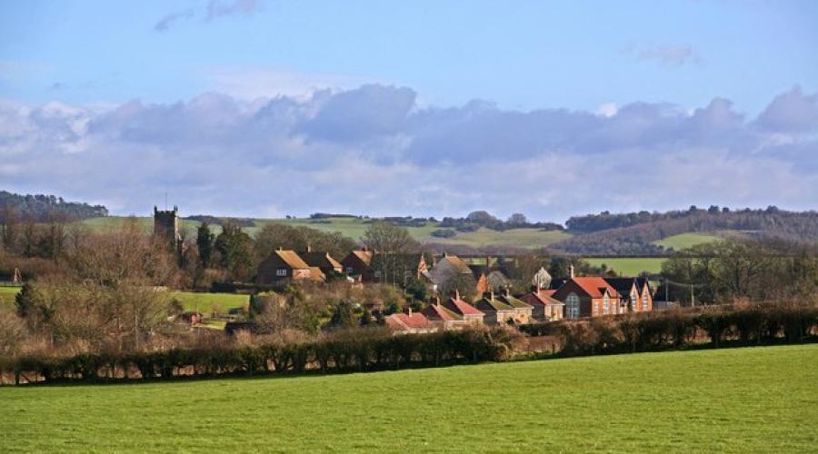
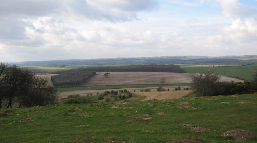
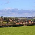
And what of the sixpenny of the title? It is the village of Sixpenny Handley, known as just Handley until the mid-19th century, a pretty place with a mostly Victorian church (St Mary, 1877) and some handsome houses amid all the archaeology.
The route starts at The Square in Cranborne and then heads southwest along the Jubilee Trail past the Manor House and out to Creech Hill House. The trail then proceeds along Ringwood Lane to Wimborne Up Monkton and then veers west then northwest along Harley Down, past numerous barrows and crossing the Cursus and then northwest past Chapel Down Farm and then northeast to Sixpenny Handley. Leaving the village in a northerly direction and then an easterly direction we'll join the Hardy Way, cross Oakley Down and see Wor Barrow. Then, having crossed the A354 and Ackling Dyke we'll head southeast to cross Blackbush Down and admire Toby's Bottom. Then, turning south, we'll head towards Cranborne to complete the walk.
Dogs are welcome to join us on this event but we do ask the following: Please ensure you adhere to the Countryside Code at all times - see (Keeping Dogs Under Effective Control) If your dog is uncontrolled and strays in open land frightening other animals or livestock, the leader is supported by the OutdoorLads board of trustees to ask you to leave the event as this is not acceptable behaviour.
IMPORTANT! - Participation Statement
You MUST complete a Participation Statement, in addition to booking your event space before attending an OutdoorLads event. You only need to complete this Participation Statement once, not for each event you attend.
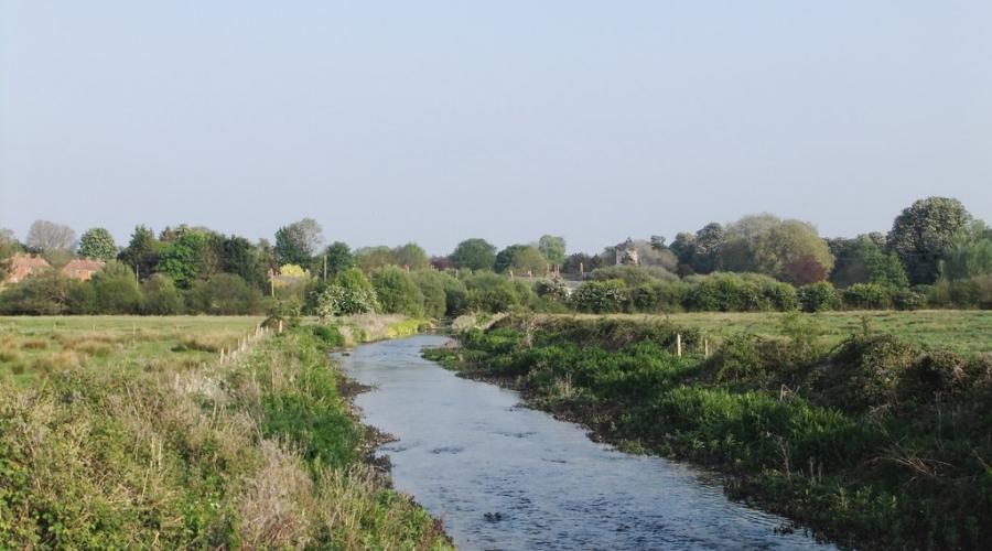
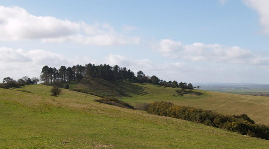
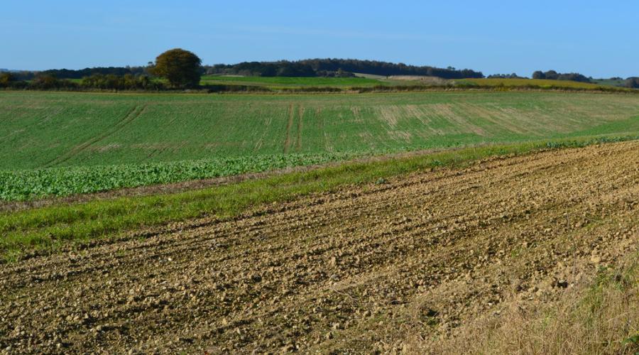
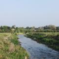
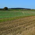
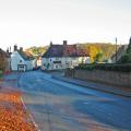
(Picture credits: On Hardy Way approaching Jack's Hedge Corner: Photo © David Martin (cc-by-sa/2.0); The River Allen, looking downstream towards Wimborne St Giles: Photo © Stefan Czapski (cc-by-sa/2.0); Ackling Dyke: Photo © Mike Searle (cc-by-sa/2.0); St Mary's Church, Sixpenny Handley: Photo © David Martin (cc-by-sa/2.0); Sixpenny Handley with Pentridge Hill in background 2: Photo © Simon Barnes (cc-by-sa/2.0); Salisbury Plantation: Photo © Lorraine and Keith Bowdler (cc-by-sa/2.0); Penbury Knoll: Photo © Adrian King (cc-by-sa/2.0); Field west of Knapp Barrow: Photo © David Martin (cc-by-sa/2.0); St Mary & St Bartholomew, Cranborne: northern aspect: Photo © Basher Eyre (cc-by-sa/2.0); Wimborne Street Cranborne Dorset; Photo © Clive Perrin (cc-by-sa/2.0). All pictures are copyrighted but are licensed for reuse under Creative Commons CC-BY-SA 2.0 and are here attributed to their copyright holders.)
What to bring
For your comfort and safety please be prepared for the anticipated weather and the terrain of the walk - keep in mind the following:
Boots: Hiking boots that are both waterproof and breathable, and provide good ankle support, are important as soon as you encounter any mud. Cross trainers may suffice in good weather and flat routes.
Socks: Proper walking socks keep your feet dry, and help prevent blisters.
Walking trousers: (ideally water resistant) will be more comfortable than Jeans which are heavy and cold when wet. From April to October shorts are usually a better bet.
Waterproof over-trousers: essential in any significant rainfall. Breathable ones are best.
Layered clothing: allows you to quickly adapt to changes in the weather as well as body temperature. E.g. a base layer or a cotton T-Shirt; a mid layer like a micro fleece, or a rugby type thick shirt, and in cooler weather an outer layer consisting of a windproof jacket or a thick fleece.
Waterproof Jacket: essential when hiking in all but the calmest of weather. You get what you pay for with these. Breathable fabrics are advisable.
Hat: essential in summer to prevent sunburn and heatstroke.
Small Rucksack: One that is comfortable to wear is essential so that you can use your arms freely. Place valuables in water proof bags inside.
Sunglassses: April- Sept: comfortable sunglasses enhance your pleasure and keep insects out of the eye
Water: even in winter one can loose a litre or more of fluid by perspiration. If you fail to make this up you'll get dehydrated which can lead to headaches and other problems. A hydration bladder is easier to use than bottled water, but higher maintenance.
Food: a packed lunch will be required unless otherwise stated. In addition carry energy bars or similar to counter 'sugar lows'.
Medicines: If you have allergies, are diabetic, or have minor ailments don't forget these!
Suncream: a high-factor for high summer as the walk is exposed, offering little shade.
Food & drink
Please bring a packed lunch and plenty to drink. There is a pub in Cranborne, The Sheaf of Arrows, for the end of the walk. There is a shop, Cranborne Stores, near the starting point in the village.