The Malverns End to End - Day Walk
21 people attending
4 places left
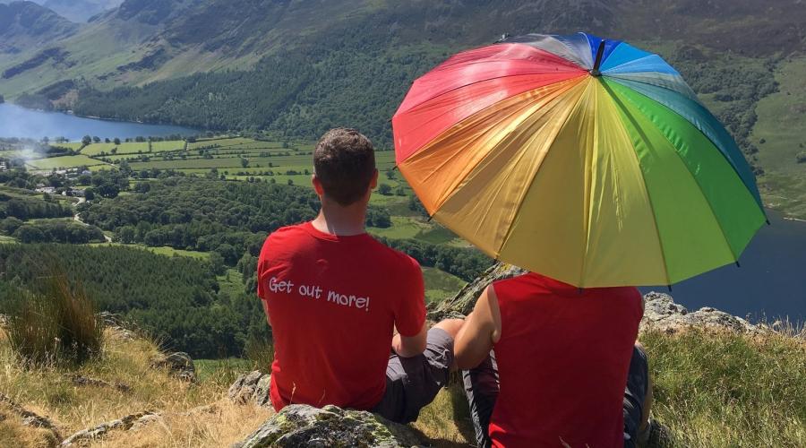
The Malvern Hills are popular with visitors all year round, offering great views and walks to suit all ages and abilities. Join TJ for this slightly more challenging than usual ramble along the ridge from Malvern to Ledbury.
We start our route at the bottom of the hills in the suburb of Malvern Link. From here the only way is up, climbing steadily to the imaginatively-named End Hill then following the spine of the hills up to the top of the Worcestershire Beacon, the highest point in the county. On a clear day you can see up to 13 counties from here!
The walk continues along the once fortified border between Herefordshire and Worcestershire, passing the Herefordshire Beacon or British Camp, site of an iron age hill fort, then the obelisk and castle at Eastnor Park before arriving in the delightful old town of Ledbury. After a drink in one of the pubs we'll head up to the station for the 20 minute journey back to the start point.
Getting there & parking
Malvern Link is served by regular trains from Birmingham, Hereford and London Paddington via Oxford. There are some parking spaces at the station which will cost £1 for the day and a further free car park at Victoria Park (WR14 2JY), about a 6-7 minute walk away.
Remember, this is a linear walk so you will need to buy a ticket to cover the return leg from Ledbury to Malvern Link. A single ticket costs £5.30.
Additional photo credits
Eastnor Obelisk cc-by-sa/2.0 - © Philip Halling - geograph.org.uk/p/6115466

What to bring
You'll definitely need comfortable walking shoes or boots and warm layers of clothing. It can get windy at the top. Please see further advice below:
Water: bring at least two litres
Medicines: if you have hay fever, diabetes, minor ailments etc.
Day rucksack: typically 20-30 litres, they are comfortable to wear and allow you to use your arms freely
Boots: waterproof and breathable and designed for hiking, trainers are OK if the ground is dry and there’s little chance of rain
Gaiters: recommended for wet weather or boggy conditions
Socks: proper walking socks will keep your feet dry and help prevent blisters
Layered clothing: lets you quickly adapt to changes in the weather and body temperature. Go for a base layer (vest or t-shirt) and a mid layer (a micro fleece or shirt) and in cooler weather add an outer layer (a windproof jacket or thick fleece)
Trousers: ideally no jeans as they become heavy and cold in the rain, breathable fabrics are more comfortable and dry and on warm days shorts are OK
Waterproof jacket: essential when hiking in all but the calmest of weather, breathable fabrics are more comfortable and dry
Gloves: Windproof, or better still, waterproof gloves are the best choice, bring a spare pair if expecting rain
Hat or cap: stay warm in winter and shaded in summer
Sunglasses: for any sunny day, even in winter
Sun cream: can be useful even on cloudy and winter days
Snacks: bring biscuits, energy bars, gels, bananas, chocolate or dried fruit for example and put them somewhere easy to get hold of
Lunch: bring a packed lunch unless otherwise stated
Food & drink
Please bring a packed lunch and plenty to drink; we will not be passing any shops during the walk but there is a supermarket near to our meeting point. As usual there'll be a pub stop towards the end of the walk.